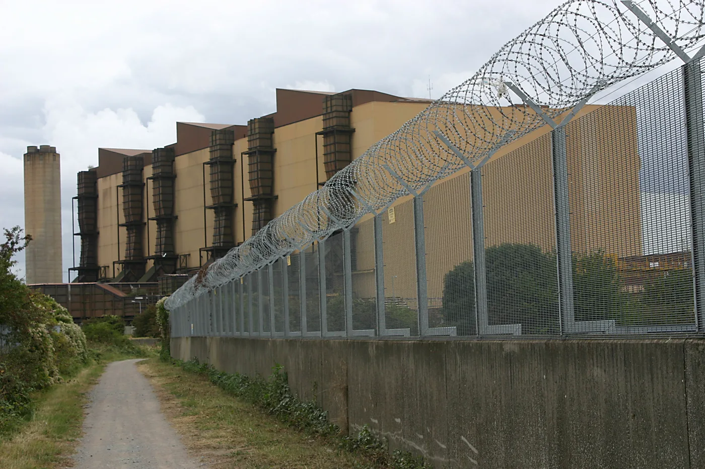

A lorry charging and HVO refuelling hub is planned for 3.3ha of the former Littlebrook power station. The council says it needs no environmental statement.
A charging and refuelling depot for lorries is being planned on a cleared 3.3 hectare parcel of the former Littlebrook power station site, off Rennie Drive. Dartford Borough Council cleared the first hurdle for it on Monday 17 August, ruling that the scheme will not need a full environmental impact assessment. (Dartford Borough Council planning register, 26/00893/SCREEN)
No planning application has been submitted yet. A screening opinion is the step before one, and the answer determines how much environmental work has to be done. The council’s decision, “EIA Not Required”, means the developer can apply without producing an environmental statement. (Screening decision, 17 August 2026)
What is being proposed
The site is 3.3 hectares inside Littlebrook Business Park. The scheme described in the screening request, submitted through planning consultancy Quod on 30 July, would include:
- a “clean multi energy hub” building, for fuelling and charging heavy and light goods vehicles
- rapid charging for electric vehicles and hydrotreated vegetable oil, or HVO, for diesel lorries
- a welfare building with small-scale retail
- a truck wash
- parking and access works
- up to about 4,000 sq m of flexible employment floorspace, in use classes B2, B8 or E(g)(iii)
The developer intends a hybrid application: full permission for the hub itself, and outline permission for the employment floorspace. (Screening request and appraisal, 30 July 2026)
The fourth phase of a very large redevelopment
Littlebrook power station closed in 2015 and every structure was demolished. What has gone up since has changed the Dartford riverside more than almost anything else in the borough. The council’s own decision sets out the sequence.
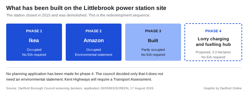
This land already has live planning permission for commercial and industrial development, granted under 24/00766/FUL. That consent has not been implemented, and the new scheme covers a similar area.
The part of the site now proposed for the hub was the power station’s substation. It has been cleared, and since then has been used as construction compounds for the new distribution infrastructure to the south west. The new Littlebrook 400kV substation sits just beyond the southern boundary. Thames Water’s Long Reach works lies to the west, on the far side of a wooded strip carrying public footpath DB8.
The nearest homes are 310 metres to the south west. The Thames is 330 metres north.
The warning buried in the decision
The council’s ruling was not a green light for the scheme itself, and one consultee made that explicit.
Kent County Council’s highways team told the council the site sits next to the A282 and M25 Junction 1a corridor, “where congestion and network resilience are established concerns”. It said the information supplied was not enough for it to check the developer’s own traffic assumptions, and that a Transport Assessment and Travel Plan will be required with any planning application. That assessment will have to model trip generation and distribution and consider effects on the Junction 1a area, along with any mitigation needed.
The Environment Agency told the council it no longer comments on screening opinion requests at all.
Why no environmental statement
The council worked through the tests in the 2017 regulations. The proposal is not Schedule 1 development, so an assessment is not automatic. The site is not in a sensitive area: no SSSI, national park, protected landscape, world heritage site or scheduled monument.
It does not fit neatly into any Schedule 2 category either. The applicant flagged the energy and infrastructure categories as a precaution. The council found the closest fit, industrial estate development, has a 5 hectare threshold, and the commercial part of this scheme is well under it. On pollution, waste and accident risk the officer concluded normal planning conditions and other legislation would deal with the issues.
Dartford Marshes Local Wildlife Site is 300 metres away and the West Thurrock Lagoon and Marshes SSSI is 1.5km off. Neither changed the answer.
What it means for you
Nothing has been approved, and nothing is being built yet. The useful thing to know is that an application is coming, and when it arrives it will not carry an environmental statement.
That matters for anyone who lives or drives near Junction 1a. The Transport Assessment will be the document that decides whether the traffic case stands up, and it is the one worth reading when the application is published. It will appear on the borough council’s register in the usual way, with a consultation period during which anyone can comment.
For a site of this size next to the crossing approach, the practical question is straightforward. A depot built to refuel and recharge lorries will attract lorries, and they will use the same roads that already lock up when the tunnel or the bridge goes wrong.
You can track new applications through our Dartford planning applications guide, and see what is already disrupting the crossing on our roadworks and travel page.
Have your say